
Northeasterly Surface Windflow nakakaapekto sa Northern Luzon
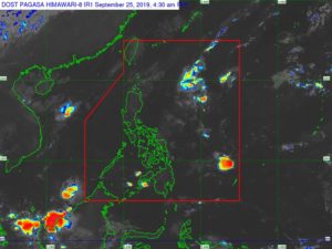 Walang nakikitang sama ng panahon o low pressure area (LPA) na makakaapekto sa bansa sa susunod na tatlong araw.
Ayon sa 4am weather update ng PAGASA, ang binabantayang isang shallow LPA ay inaasahang matutunaw din pagpasok ng Philippine Area of Responsibility (PAR).
Samantala, dahil sa northeasterly surface windflow, makararanas ang Batanes, Isabela at malaking bahagi ng Cagayan Valley ng makulimlim na kalangitan na may pulo-ulo at panandaliang mga pag-ulan.
Sa Metro Manila, nalalabing bahagi ng Luzon, buong Visayas at Mindanao, asahan naman ang magandang panahon na may posibilidad lamang ng mga pag-ulan sa hapon o gabi dahil sa localized thunderstorms.
Samantala, nakataas ngayon ang gale warning at ipinagbabawal ang paglalayag sa mga baybaying dagat ng Batanes, Babuyan, northern coast ng Cagayan at northen coast ng Ilocos Norte.
Disclaimer: The comments uploaded on this site do not necessarily represent or reflect the views of management and owner of Cebudailynews. We reserve the right to exclude comments that we deem to be inconsistent with our editorial standards.